French Levant
Covers and stamps / French Levant / Proofs / Maps
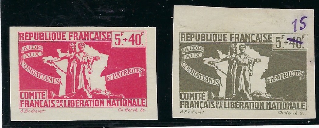
(French Committee of National Liberation) 1943 Aid to Resistance imperforate proofs for a 5f+40f in red and top marginal 5f+40f in grey, the ‘40’ erased and “15” added in manuscript, unused without gum.
£115
Greece
Covers and stamps / Greece / Illustrated / Maps
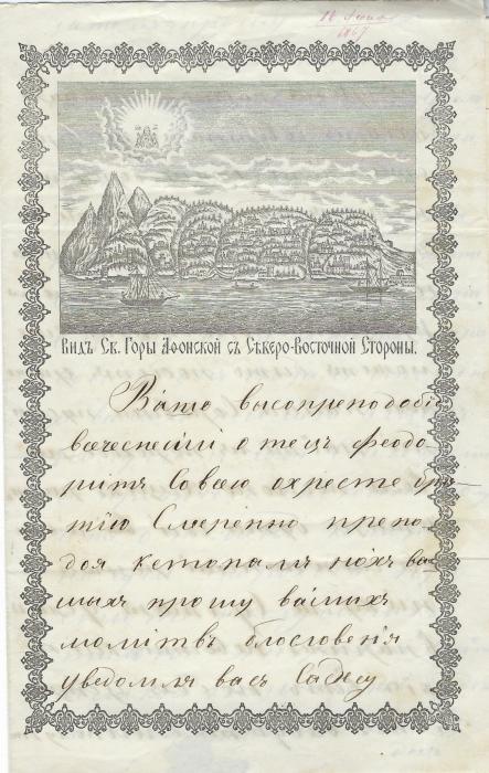
(Mount Athos) 1867 very fine illustrated letter sheet, sent internally, showing fine stylized vision of the peninsula.
£175
Greece
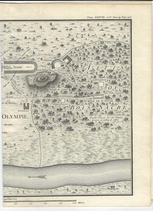
Covers and stamps / Greece / Maps / Olympics
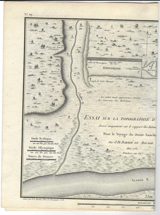
(Olympics) 1780 Map of ancient Olympic site from a book ‘Pour le Voyage du Jeune Anacharsis’, a fictional work abouth the travels of the Scythian sage Anacharsis in Greece in the middle of the 4th Century, written by Jacques Barthelemy and published in 1788; with vertical fold
£85
Philippines
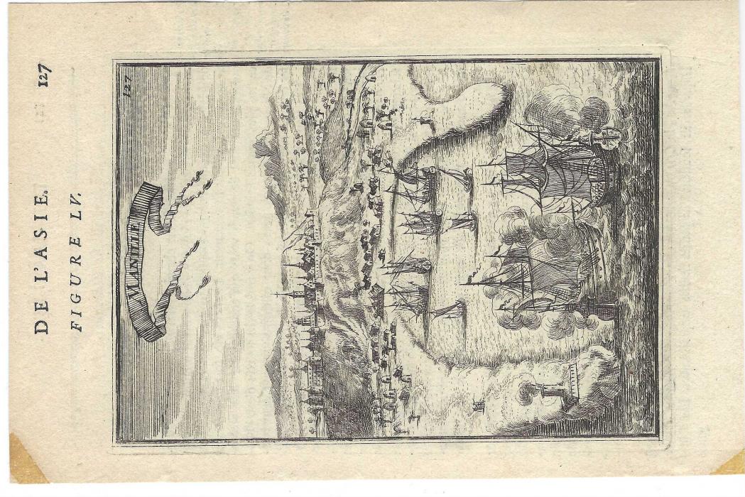
Covers and stamps / Philippine Is / Maps
1683 small engraved map ex Mallet, page 127 depicting ships at Manilla, two stained corners from mounting; fine early item.
£125
Gambia
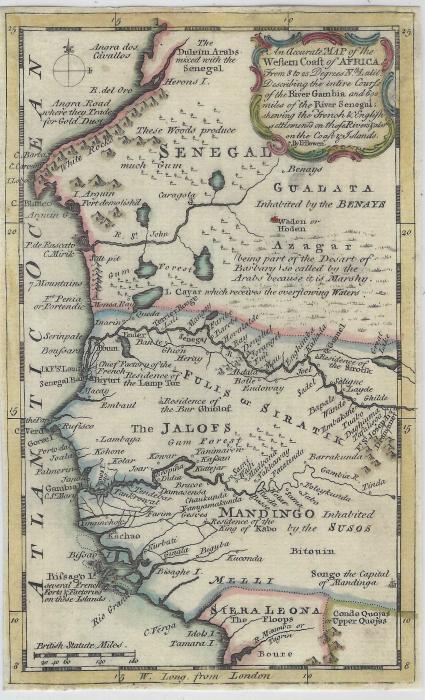
Covers and stamps / Gambia / Senegal / Maps
1747 Samuel Bowen colour map showing west coast of Africa describing the entire course of the River Gambia and 600 miles of River Senegal. Fine condition 115 190mm
£75
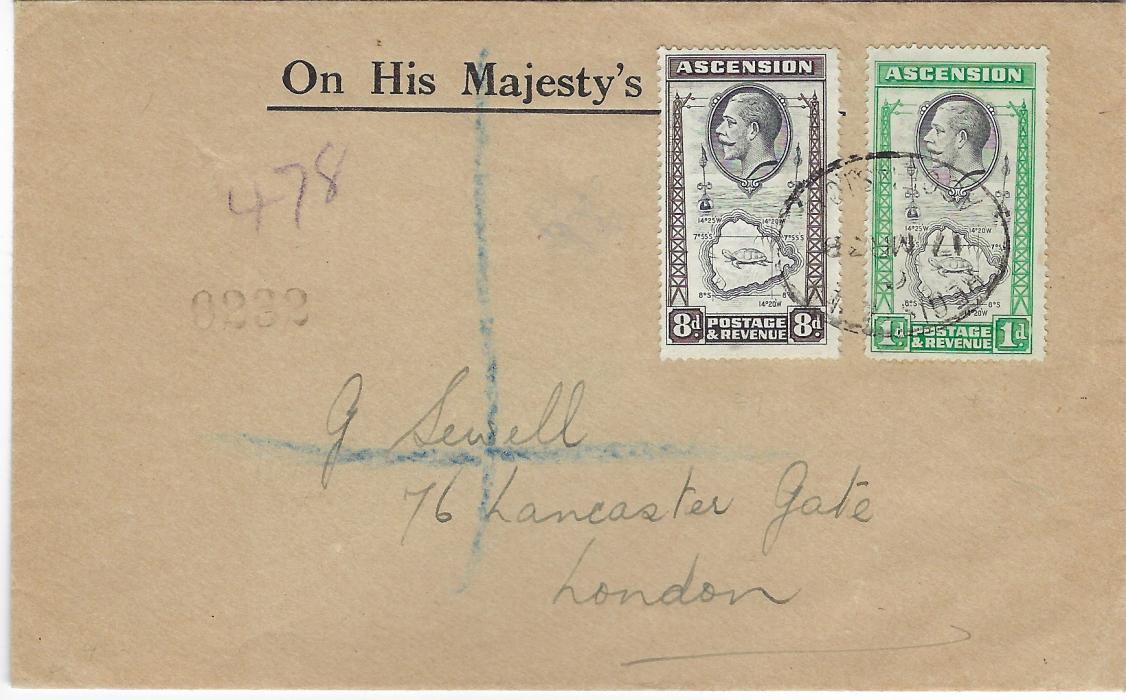
Ascension
Covers and stamps / Ascension / Maps / Turtle Tortoise
1936 (17 MR) registered ‘On His Majesty’s Service’ envelope to London franked 1d. and 8d. of same Map and Tortoise design tied by single registered oval date stamp, without arrival cancels.
£65
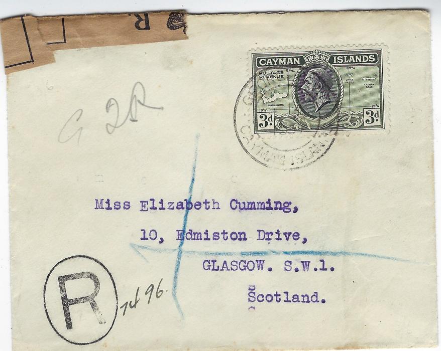
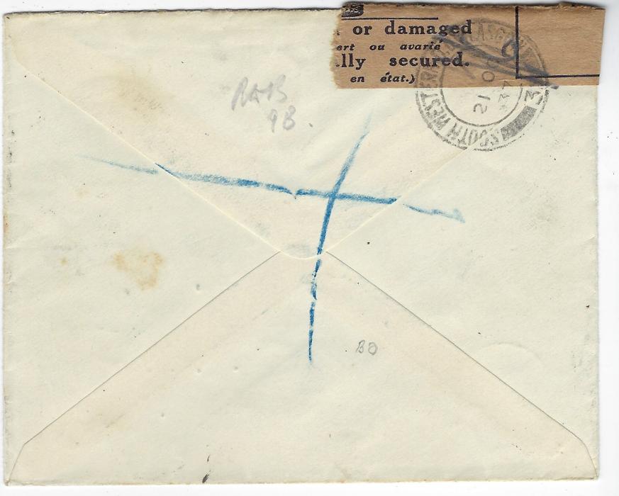
Cayman Islands
Covers and stamps / Cayman Islands / Maps / Officially Sealed / Scotland
1937 registered cove to Glasgow, Scotland bearing single franking 3d. Map tied Georgetown cds. The left corner with Post Office sealing tape tied by South Western S.O. Glasgow cds; unusual on a Caymans cover.
£55
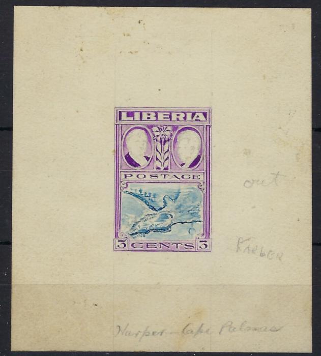
Liberia
Covers and stamps / Liberia / Proofs / Maps
1952 hand-painted 3c. Harper Map working proof in violet and blue. The two busts at top not complete, the right-hand one similar to issued stamp, the one at left at a very different angle, a few manuscript annotations; fine and unusual.
£195
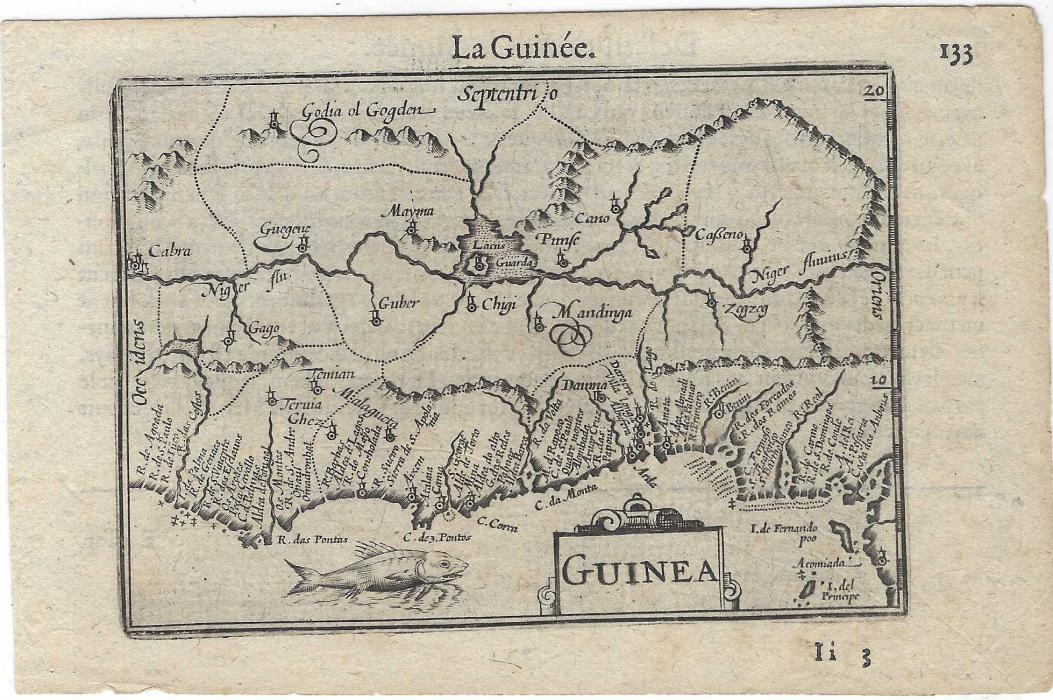
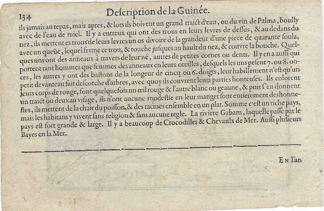
Spanish Guinea
Covers and stamps / French Colonies / Portuguese Colonies / Spanish Giunea / Maps
Circa 1600 black and white Map (123 x 88mm) entitled ‘La Guinee’ showing the Island of Fernando Poo, with description of Guinee on reverse
£85
French Congo
Covers and stamps / French Congo / Maps
Eighteenth Century colour map, 100 x 145mm with text on reverse about San Salvador, capital of Congo; good condition.